
Zoning Slices
GIS layers that merge base and overlay districts into unique geometric combinations (“Slices”) to compute prevailing regulations — so you don’t have to.
WHAT ARE ZONING SLICES FOR?
Advanced Analysis · Data Integration
Geospatial Visualization · Scenario Planning
Site Selection · User Portals
Super-power your analysis with Zoning Slices.
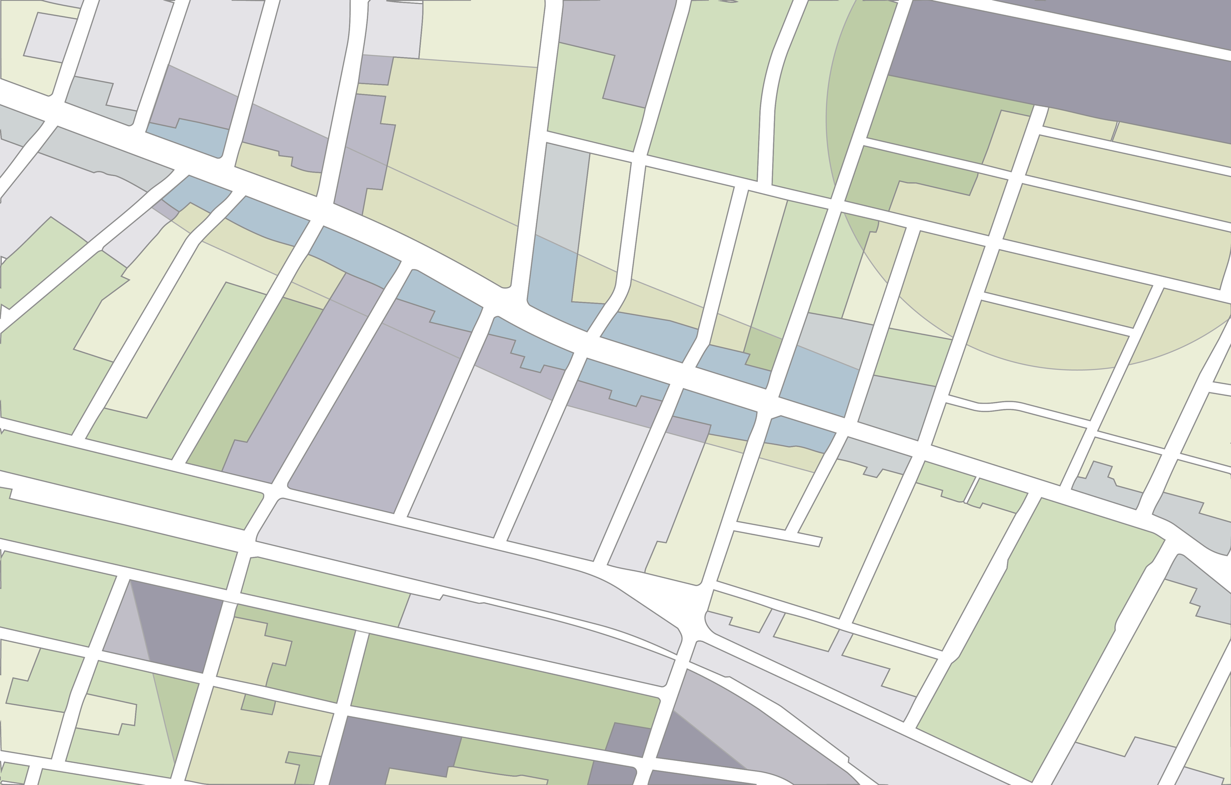
If you’re interested primarily in regulatory outcomes, Zoning Slices — each a unique geometric combination of base and overlay districts — may be what you’re looking for.
Our 150,000+ Zoning Slices are made using a two-step flattening procedure that collapses multiple overlapping districts districts into a single polygon — isolating the prevailing regulation across a host of zoning attributes: from residential treatments and parking requirements to height caps and minimum lot sizes.
The result is a dataset where every inch of land has exactly one set of governing rules, enabling advanced analysis and integration into data pipelines. You (or we) can combine Zoning Slices with your parcel data to produce tailored results, including site selection evaluations.
Zoning Slices are priced on a per-variable basis, with tiered pricing for standard variables and premium variables that we customize to meet your needs.
-
Information from zoned jurisdictions published to the National Zoning Atlas at the following scales:
Jurisdictions
Counties
Core-Based Statistical Areas (i.e., metropolitan and micropolitan areas)
States
-
The Zoning Slice: a unique geometric combination of base and any overlay district(s)
If you need us to join Slices to parcels and you don’t have parcel data, we suggest Regrid.
-
Zoning Slices can include one or many variables, including:
Residential use permissions (for 1-, 2-, 3-, and 4+-family housing, and accessory dwelling units)
Minimum lot size requirements (for 1-, 2-, 3-, and 4+-family housing)
Parking mandates and height caps
Treatment of specialized housing types, including:
Accessory dwelling units
Affordable housing
Planned residential developments
Consult the Data Dictionary for a full list of options, including custom options.
-
GeoPackage, GeoJSON, or Geodatabase
Spatial join to your parcels (optional)
See for yourself.
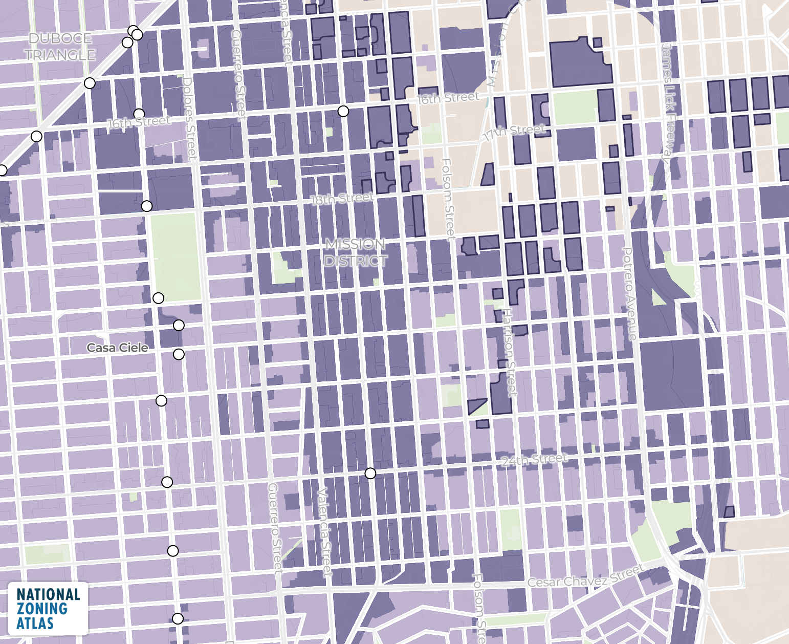
Choosing between Zoning Districts and Zoning Slices?
The sample GeoJSONs linked below include Zoning Districts and Zoning Slices for Agoura Hills, California.


Zoning Slices
Reveal how different places are regulated and show the “end result” of the overlapping district rules.
Download SampleZoning Slices
Pick a geography, choose your data variables, and get instant pricing.
Type in the name of the jurisdiction (e.g., city, town, township, county) without typing in the state name. Then select the jurisdiction from the results.
Use the checkboxes to select each variable (or set of related variables sold together). All variables are further explained in our data dictionary. Each order includes all base variables listed in the data dictionary. Hover over any checkbox for details.
Pick a geography to get started.
Zoning Slices are packaged as GeoJSON or GeoDatabase files
Long live accessible zoning for everyone.
By licensing our data, you support the National Zoning Atlas.