
Zoning Attributes
Zoning Attributes can integrate into your data pipeline to show how regulatory outcomes affect individual parcels or addresses.
WHAT ARE ZONING ATTRIBUTES FOR?
Data Integration · Site Selection · User Portals
Geospatial Visualization · Regulatory Analysis
Reach out for a quote!
This product is ready for delivery. Contact us using the form below to receive a quote.
Integrate Zoning Attributes into your workflow.
Zoning Attributes are perfect for people who want to understand how zoning works in individual parcels. They can be integrated into public-facing or subscriber maps, used for site selection evaluations (including from long lists of addresses), and deployed in sophisticated visualizations and analysis.
To build Zoning Attributes, we use our Zoning Slices, each a unique geometric combination of base and overlay districts, which compute prevailing regulations. We combine the Slices with your parcel data to produce tailored results. Zoning Attributes are priced on a per-variable basis, with tiered pricing for standard variables and premium variables.
Peruse the Zoning Attribute Data Dictionary to learn about available variables, and use the drop-downs below to explore more.
-
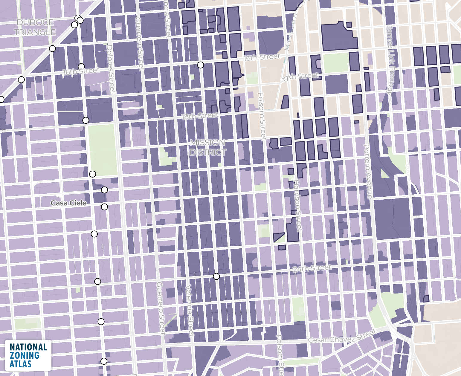
Information from zoned jurisdictions published to the National Zoning Atlas at the following scales:
Jurisdictions
Counties
Core-Based Statistical Areas (i.e., metropolitan and micropolitan areas)
States
-
The parcels (as provided by the client)
We suggest Regrid for your parcel needs!
-
It’s up to you! Zoning Attributes can include data about a parcel’s:
Basic properties, such as its use type
Residential use permissions (for 1-, 2-, 3-, and 4+-family housing, and accessory dwelling units)
Minimum lot size requirements (for 1-, 2-, 3-, and 4+-family housing)
Parking mandates and height caps
Treatment of specialized housing types, including:
Accessory dwelling units
Affordable housing
Planned residential developments
As well as a range of premium variables shown in the Data Dictionary below.
-
CSV
GeoPackage, GeoJSON, or Geodatabase
Interested in Zoning Attributes?
Fill out the details and we’ll get back to you with a quote ASAP.
Data Dictionary
This data dictionary lists each field used in the Zoning Attributes, and includes the field’s format (numeric, integer, logical, character, or date), descriptive name, data example, and description.
Long live accessible zoning for everyone.
By licensing our data, you support the National Zoning Atlas.