
Our Methodology
Land Use Labs draws from a time-tested methodology originating with the National Zoning Atlas to collect and maintain zoning data, and has developed additional protocols for new products and custom analysis.
Learn more about how we collect information about zoning districts and jurisdictions, and how and why we create Zoning Slices.
Districts
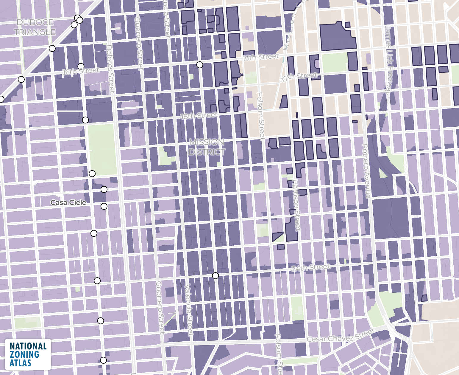
Land Use Labs has the most accurate and most comprehensive collection of zoning data currently on the market. Painstakingly collected by experienced planning professionals, our data covers more than 100,000 zoning districts.
We construct zoning district data through a standardized methodology designed to translate complex local regulations into consistent, comparable data. For each jurisdiction, our analysts collect and review the full zoning ordinance—both text and map—logging as many as one hundred rules for each district. District boundaries are digitized and spatially aligned, while regulatory attributes specifying use, lot, and structure characteristics are encoded into our structured data schema.
To ensure consistency across jurisdictions, all districts are processed through a multi-stage validation workflow. Analysts apply standardized definitions to harmonize zoning rules across places, enabling the direct regulatory comparison across geographies. Quality assurance reviews evaluate internal consistency, confirm alignment between mapped boundaries and written regulations, and document how ambiguities are resolved. Districts are only included in the final dataset after passing these checks, producing a verified, nationally consistent layer of zoning regulations ideal for mapping, policy analysis, comparative research, city and regional planning, and more.
Learn more about the potential of Zoning Districts.
Jurisdictions
Land Use Labs has amassed an unprecedented repository of information about jurisdictions: governmental and nongovernmental entities with the potential to exercise zoning authority. Numbering over 33,000 across the U.S., jurisdictions primarily include cities, towns, and counties, though other public and even private entities may also be granted zoning authority. To date, we have logged zoning conditions for more than 9,200 jurisdictions from coast to coast, as well as all of Alaska and Hawaii.
Jurisdiction-level outputs are generated by aggregating underlying Slice data into consistent summary metrics. These metrics quantify the distribution of different zoning characteristics across land area, enabling easy comparison of zoning rules across jurisdictions of different sizes and governance structures.
Want summary stats about completed jurisdictions? Check out our Zoning Tables!
Slices
Zoning Slices are constructed to represent the combined effect of multiple overlapping zoning regulations on a single geography. Because zoning codes frequently layer overlay districts on top of base districts, a single location may be subject to multiple—and sometimes conflicting—rules. To address this, we generate Slices by merging base districts with all applicable overlays, producing unique geometries where the full set of governing regulations can be evaluated together. This approach avoids analytical errors that can arise from treating base and overlay districts independently.
We currently maintain around 150,000 Slices. To create them, we stack up layers of regulatory information about all districts governing a specific parcel or group of parcels and then “flatten” the layer into one. Where one overlay sits atop a base district, the overlay’s conflicting regulations prevail. Where there are two or more overlays, we attribute the most restrictive regulation to the Slice. We developed this process to facilitate the accurate display of a complex regulatory environment on the National Zoning Atlas map and Zoning Snapshots and to enable further statistical analyses.
Now you can secure Zoning Slices to power up your analysis.
Long live accessible zoning data for everyone.
By licensing our data, you support the National Zoning Atlas.
Land Use Labs is a mission-driven social enterprise created to ensure the NZA — the country's most authoritative zoning resource—stays current, free, and available to all.